
Canada Parcels
A downloadable spreadsheet of our Canada Parcels Schema is available here: Canada Parcels Schema
The Regrid Canada Parcels product provides parcel boundaries from local, provincial, and federal sources to give a foundational level of property location intelligence to users. Containing parcel boundaries nationwide across all 13 Canadian provinces and territories with a standard schema, Regrid Canada Parcels offers a single source for common-format parcel boundary data in Canada.
Data Delivery
Regrid Canada parcels are available in all of our parcel data file formats. The data is delivered at the province/territory level. Data licensing is available at either the national or provincial/territorial level.
Files are available via SFTP and cloud delivery.
Data Details
Our Regrid Canada Parcels Data Dictionary contains a schema, data dictionary, and coverage report for the Regrid Canada Parcels product.
Data Sourcing
The Regrid Canada Parcels are from authoritative local, provincial, and federal government sources. Regrid only provides actual parcel boundary data and does not rely on machine-learning techniques to create modeled or assumed parcels.
Updates
Regrid is updating the Canada Parcels product 2x per year and providing updates to users at this same cadence. Update dates may vary and are expected in Fall and Spring.
Regrid Parcels Canada data coverage
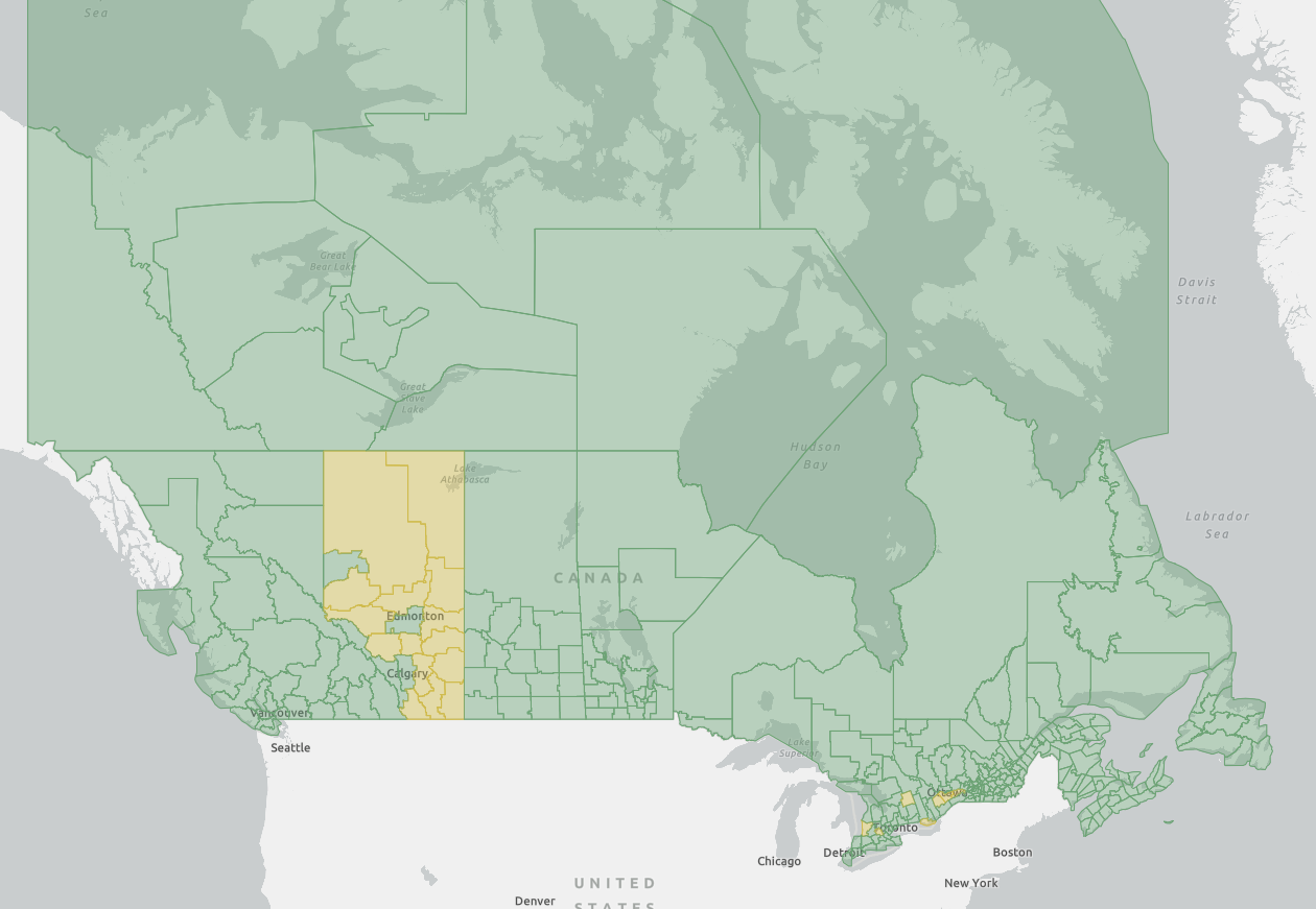
The best place to explore the coverage of Canada Parcels is on our Regrid Canada Parcels Coverage Report. This report contains both a province/territory level summary (Admin1), as well as a breakdown of coverage by individual Census Subdivisions (Admin2) within each province. Within the Census Subdivision breakdown, we include a total parcels count and a “admin2_coverage_pct” field which reflects the total area (land and water) of the census subdivision that is covered by parcels. This can be an indicator of how much of the census subdivision contains parcels.
Attribution for Regrid Canada Parcels
Regrid has intentionally focused on the buildout of parcel boundaries over attribution. That said, Regrid is supporting a small set of attributes with the Regrid Canada Parcels product. Those attributes are broadly described by the categories of: official identifiers (parcel number, etc), situs address, calculated area in square meters, and metadata (such as last refresh dates, and unique id). The full schema and data dictionary is always available.
Canada Data FAQs
We're pleased to offer an excellent Canadian parcel dataset to our users. Additional information about this dataset can be found on this companion support page. Because the US and Canada are different countries with separate histories and legal systems, the data available between the two countries varies. Below, you'll find a helpful primer on the most commonly-asked Canada data questions that we've heard. As always, if you have a question and don't see an answer below, you are welcome to get in touch with our support team - [email protected].
What is your coverage like in Canada?
Our Canada Parcel Boundaries dataset contains over 9.2 million parcels across all 13 provinces and territories. This is not 100% coverage of all land in Canada, but it is a good representation of the data available.
That's because there are swaths of Canada where property data either has never been digitized, or is not made available to anyone outside governmental agencies/functions.
Over time as additional parcels become available, we'll add it to our dataset - just like we did in the US until we achieved 100% coverage.
Is owner information available in Canada?
Owner info & mailing address is not available in Canada. This is in compliance with Canada's privacy policy on data that can carry personal information related to individuals. PIPEDA legislation forbids making information such as owner name available.
I see more fields available in the US than in Canada. What's up with that?
Varying levels of data richness is a reflection of the two countries' different approaches to parcel data in general. Check out the Canada Schema to see what's available currently. Canada's parcel data sources simply do not have many attributes attached, compared to the rich data we get from US sources. In some cases, parcel data contains the spatial boundary info - and not much else.
As time goes on, we will be working to enrich the Canadian data we get with additional fields that we can mix in ourselves from additional sources. Examples of this could be things like perceived land use, structure/no structure on parcel, and a variety of other things we're not ready to talk about publicly (yet!). We'd love to hear what would be most valuable to you. Please don't hesitate to reach out to us at [email protected] with requests or suggestions.
Updated 5 months ago