FEMA Flood Hazard Layer
In the Regrid Property App, we provide a FEMA Flood Hazard layer that users can toggle on and off via the Layers button ( icon bottom right of the map UI). When you toggle the layer on, areas in various flood zones will show on the map, often with codes that describe the specific type of flood zone.
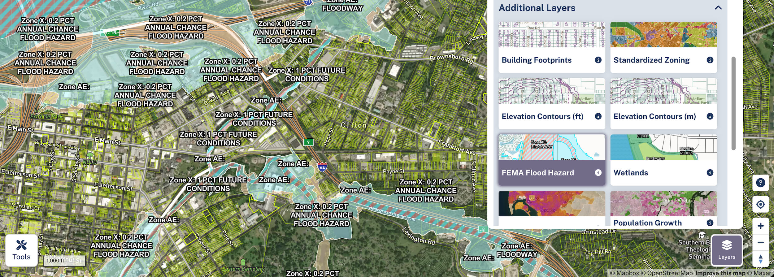
FEMA Flood Zone Types
| Zone | Description |
|---|---|
| Zone A | Areas with a 1% annual chance of flooding and a 26% chance of flooding over the life of a 30-year mortgage. No base flood elevations are provided. |
| Zone A99 | Areas with a 1% annual chance of flooding that will be protected by a federal flood protection system where construction has reached specified statutory progress toward completion. |
| Zone AE | Areas with a 1% annual chance of flooding where base flood elevations are provided. |
| Zone AH | Areas with a 1% annual chance of shallow flooding, usually in the form of ponding, where average depths are between 1 and 3 feet. Base flood elevations are provided. |
| Zone AO | Areas with a 1% annual chance of shallow flooding, usually in the form of sheet flow, where average depths are between 1 and 3 feet. Depths are provided. |
| Zone V | Coastal areas with a 1% or greater chance of flooding and an additional hazard associated with storm waves. No base flood elevations are provided. |
| Zone VE | Coastal areas with a 1% or greater chance of flooding and an additional hazard associated with storm waves. Base flood elevations are provided. |
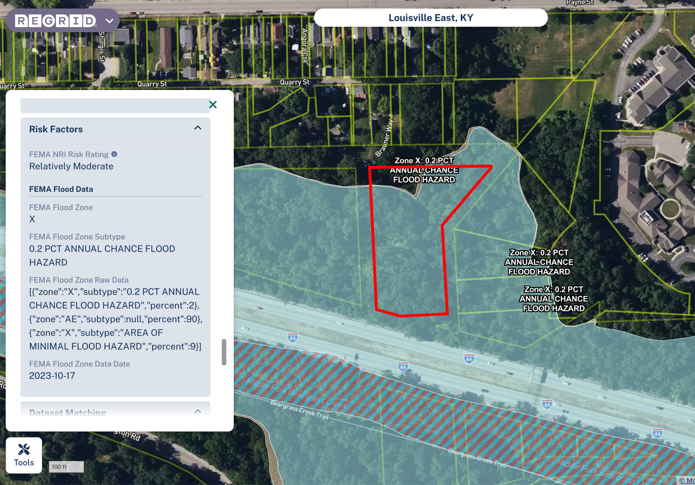
| Zone X | Areas of moderate flood hazard, usually the area between the limits of the 100-year and 500-year floods. Also used to designate areas of minimal flood hazard. |
Other Ways of Working With FEMA Flood Data
The Regrid team has also extrapolated this flood risk dataset to individual parcels as well, meaning you can see this FEMA data represented in the parcel details, and Style/Filter for specific flood zones as well.
Where does this data come from?
The data is drawn from the National Flood Hazard Layer (NFHL), a dataset created and maintained by the Federal Emergency Management Agency (FEMA).