
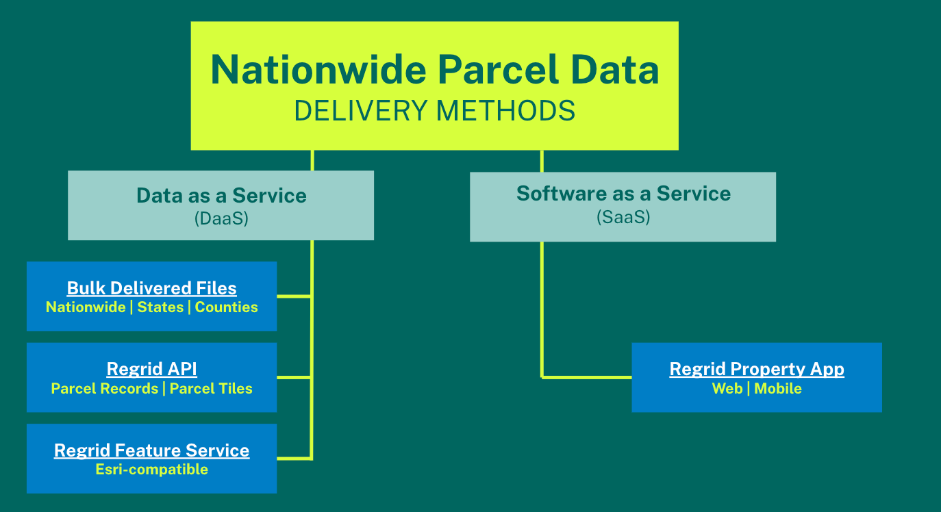
Our Delivery Methods


FAQs
Regrid is an industry-leading property data and location intelligence company.
Our observation is that land parcels connect everything, and so our core service is providing you with land parcel data matched to additional property and location datasets.
We serve an array of industries that require land parcels and spatial data at scale, including real estate, insurance, energy, infrastructure, agriculture, logistics, and government.
We also serve a popular audience centered around our accessible land parcel software and mobile app, and we pride ourselves on having a big front door.
Just like our data and our customers, you’ll find the Regrid team spread all across America: Detroit, Ann Arbor, Miami, Dallas, Cleveland, Philadelphia, Minneapolis, San Diego, Fresno, Michigan’s Upper Peninsula, and elsewhere.
Regrid was founded as Loveland Technologies in Detroit, Michigan in 2009. Prior to being known as Regrid, we were known as Landgrid.
Regrid is a leading provider of high-quality, standardized nationwide land parcel & location context data. We tirelessly assemble and refresh our nationwide dataset, then weave it all into a standardized schema that makes it easy to work with. Our data is available by the entire nation, state & county via bulk delivered files, API, Esri-compatible Feature Service and mapping app (Regrid Property App)
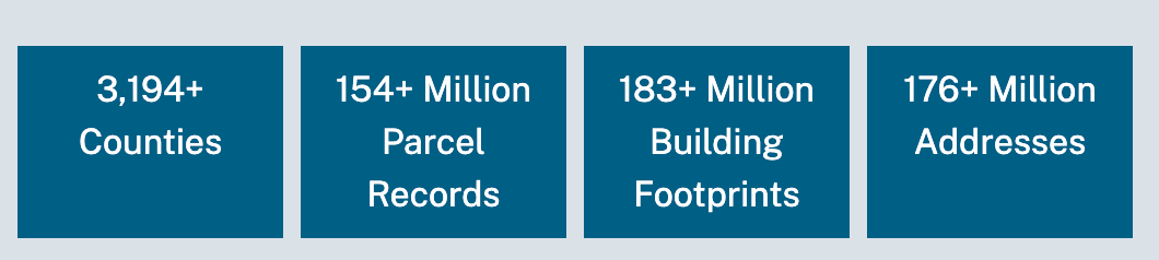
Also called Cadastre data, Parcel Data is the exacting identification of every owned, transacted, invested, and taxed property in this country. Land parcels are primarily property boundaries or shapes which include parcel geometry and centroids.
At Regrid, we specialize in the spatial accuracy of parcel geometry & shape, however, we don’t stop there. We provide associated location context & assessment information for parcels at a nationwide level, including owner, situs address, mailing address, parcel id, persistent Regrid UUID, normalized land use codes and much more.
Yes, We tirelessly collect, curate, QC, assemble and refresh our nationwide dataset. We source our data directly from each county or whom they designate as the official source for their parcel data.
Regrid is a creation of Loveland Technologies. Regrid was founded as Loveland Technologies in Detroit, Michigan in 2009. Prior to being known as Regrid, we were known as Landgrid.
We list our pricing on our site for all of our delivery methods.
- Nationwide & State Bulk Data Pricing - https://regrid.com/parcels
- County pricing is available on our self-serve data store (you can license and download data by the county and state instantly on the data store) - https://app.regrid.com/store
- Self-serve API pricing - https://regrid.com/api/plans
- Property app pricing - https://regrid.com/saas
If you are interested in learning more about our data and want a sample, please email us at parcels@regrid.com.
For our self-serve property app, API and store support, please email us at help@regrid.com.
If you are a data & API customer, for support inquiries, please contact us at tech@regrid.com.
We are always here to help.