ArcGIS Pro
These steps will add Regrid's seamless nationwide parcel layer to an ArcGIS Pro project. They were tested in ArcGIS Pro v3.1.0
-
Launch ArcGIS Pro Desktop on Windows
-
Open a new or existing project.
-
Ensure the project has a map. To create a new map, from the Insert tab, select New Map
-
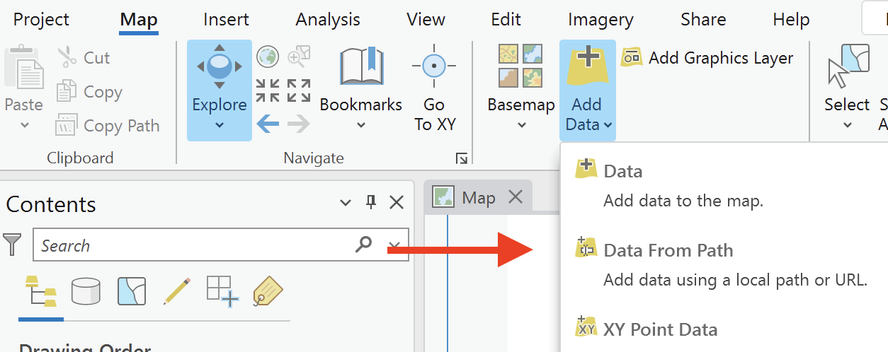
From the Map tab, select Add Data, and then select Data from Path
-
Paste the following URL into the Path field, replacing
<token>with your Regrid API token:https://fs.regrid.com/<token>/rest/services/premium/FeatureServer/0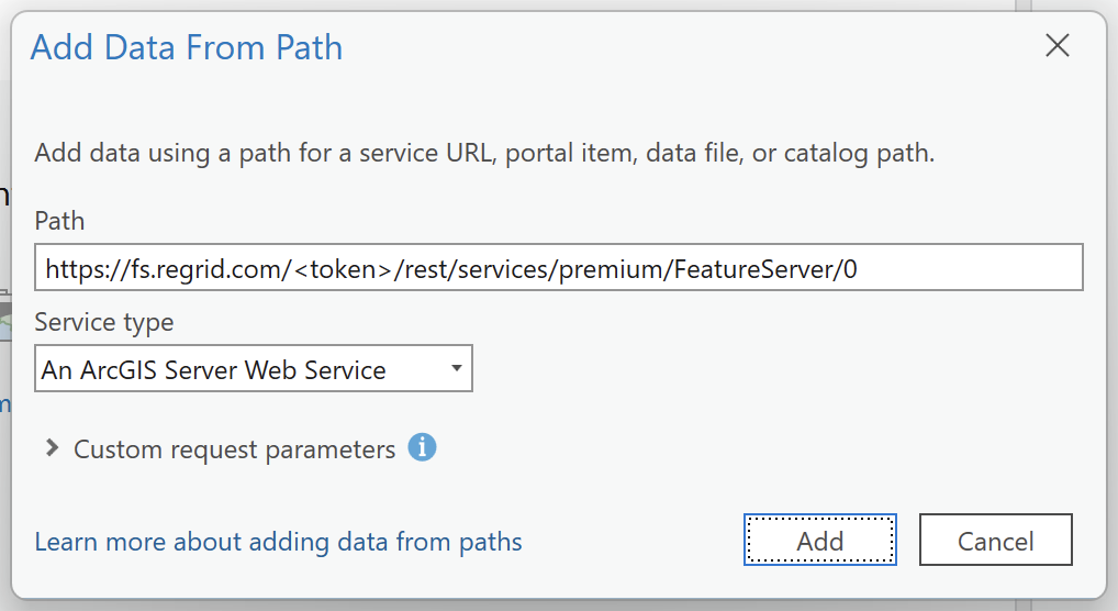
-
Click Add.
-
Parcels should be rendered on a new layer in the map view. "Regrid Parcel Data" should appear in the Contents pane.
Troubleshooting access problems
If you receive an error that says "We are unable to connect" or "Invalid Path", your network administrator may need to unblock access to our Feature Service. Please check with them to ensure the service can be accessed. This is common in managed ArcGIS Enterprise environments.
One way to check if the Fature Service is blocked is to load the same URL you paste into ArcGIS in your web browser. If the browser displays a message about the content being blocked, contact your adminstrator.